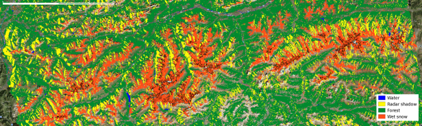
The Wet (melting) Snow Cover Product over the Alps is generated using an algorithm optimized for unforested, high alpine terrain. Radar satellite data (Sentinel-1 SLC IW) and a digital elevation model are used as data base.
The product contains the bianry classes wet (melting) snow, snow free (or cold snow), forested areas, open water areas and radar shadow / layover. The spatial resolution of the product is 100 m. The product coverage depends on the available Sentinel-1 radar image acquisitions. The product is updated one to two times per week per pixel. The product is stored as raster file, with Integer Codes for Classes. The product is derived from repeat pass radar satellite data, and provides informaiton on melting snow areas, independent of cloud cover.
The wet snow cover service is provided by ENVEO within the EU FP7 project SEN3APP (2013 - 2016).
© ![]()
![]()
____________________________________________________
Spatial Resolution: 100 m
Temporal Frequency: Multi-temporal
Data Base: Radar Satellite Data
and Digital Elevation Model
____________________________________________________