CryoLand offered a portfolio of glacier products, based on high resolution multi-spectral optical satellite data and SAR data. Software tools for retrieving the various glacier products, developed and applied by the project partners over many years, are available for the project. In the CryoLand project the related work deals with developments for fine-tuning the products to meet the user needs.
Available inventories of glacier areas are traditionally based on aerial photogrammetry. In many countries, including several European countries, the inventories of glacier area are many years old and outdated, due to the rapid glacier retreat proceeding during the last two decades. The Global Land Ice Measurements from Space (GLIMS) initiative (http://www.glims.org/) is aimed at compiling a global data base of glacier outlines in digital format from optical satellite data (Raup et al., 2007). However, GLIMS is still far away from the indented global coverage of glaciers. Many glacier regions are not yet covered, and in others the satellite data base is already several years old. Moreover, the product type is not optimized for applications in hydrology and water management. These deficits will be overcome by CryoLand, providing accurately geocoded, high resolution maps of glacier areas and other glacier parameters on user request, based on high resolution satellite images such as SPOT-5, Ikonos, and later on Sentinel-2.
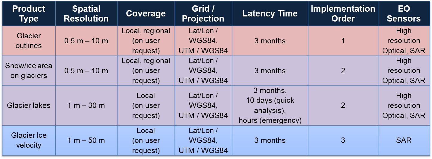
The following glacier products are offered by the CryoLand Glacier Service: